Our blog tracks Jose Arguelles' Dreamspell Calendar. "As chaos and confusion rise, galactic consciousness based on the Law of Time serves as planetary medicine, lifting us into the awareness that we exist within a higher, more expanded realm of existence than the world of third-dimensional form and appearance. Daily practice will elevate consciousness and increase experiences of synchronicity." (Arguelles)
The Choctaw Nation of Oklahoma (commonly referred to as the Choctaw Nation) is a federally recognized Native American tribe with a tribal jurisdictional area comprising twelve tribal districts. The Choctaw Nation maintains a special relationship with both the United States and Oklahoma governments. As of 2011, the tribe has 223,279 enrolled members, of which 84,670 live within the state of Oklahoma. The tribal jurisdictional area is 10,864 square miles (28,140 km2). A total of 233,126 people live within these boundaries, the majority of whom are not Choctaw. The tribe has jurisdiction over its own members.
The chief of the Choctaw Nation is Gary Batton, who took office on April 29, 2014 after the resignation of Gregory E. Pyle. The Choctaw Nation Headquarters is located in Durant. The Choctaw Capitol Building is in Tuskahoma; it is now used as the Choctaw Museum and home to the Judicial Department Court System.
The Choctaw Nation is one of three federally recognized Choctaw tribes; the others are the Jena Band of Choctaw Indians and Mississippi Band of Choctaw Indians. The latter two bands are descendants of Choctaw who resisted the forced relocation to Indian Territory. The Mississippi Choctaw preserved much of their culture in small communities and reorganized as a tribal government under new laws after the Indian Reorganization Act of 1934.
Those Choctaw who removed to the Indian Territory, a process that went on into the early 20th century, are federally recognized as the Choctaw Nation of Oklahoma. The removals became known as the "Trail of Tears."
The Tribal Headquarters are located in Durant. It is a complex of three three-story buildings, and several one-story buildings. The current chief is Gary Batton and the assistant chief is Jack Austin, Jr.
The Tribe is governed by the Choctaw Nation Constitution, which was ratified by the people on June 9, 1984. The Constitution provides for an Executive, a Legislative and a Judicial branch of government. The Chief of the Choctaw Tribe, elected every four years, is not a voting member of the Tribal Council. They are also elected for four-year terms. The legislative authority of the Tribe is vested in the Tribal Council, which consists of twelve members.
Before Oklahoma was admitted as a state to the union in 1907, the Choctaw Nation was divided into three districts: Apukshunnubbee, Moshulatubbee, and Pushmataha. Each district had its own chief from 1834 to 1857; afterward, the three districts were put under the jurisdiction of one chief. These districts were abolished at the time of statehood, as tribal government was dissolved. The tribe later reorganized to re-establish its government.*
The Congaree (also spelled Conagree) were a group of Native Americans who lived in what is now central South Carolina of the United States, along the Congaree River. They spoke a dialect distinct from, and not intelligible by, Siouan language speakers, the primary language family of the area.
The Congaree lived along the Santee and Congaree rivers, above and below the junction of the Wateree, in central South Carolina. They occupied territory between the Santee tribe below them and the Wateree tribe above. Native Americans sold as slaves were members of other tribes captured in war or raids. By 1693, Congaree, Esaw and Savannah slave-catchers had pursued the Cherokee as "objects of the slave trade to the extent that a tribal delegation was sent" to Governor Thomas Smith. They sought protection, claiming that Cherokee had been sold in the Charles Town slave market. In 1698, the Congaree lost "most tribe members to smallpox." The English explorer John Lawson encountered the survivors in 1701, apparently on the northeastern bank of the Santee River below the junction of the Wateree. Lawson described their village as consisting of about a dozen houses, located on a small creek flowing into Santee River. They were a small tribe, having lost heavily by tribal feuds, but more especially by smallpox, which had depopulated whole villages. But a 1715 map shows their village as located on the southern bank of the Congaree and considerably above the previous area, perhaps about Big Beaver creek, or about opposite the site of Columbia, on the eastern boundary of Lexington county. They may have been moving upriver to get further away from English colonists. During the Tuscarora War of 1711, the Congaree fought on the side of English colonist John Barnwell, who raised a militia. In early 1715 John Barnwell took a census, which identified the Congaree as living in one village, with a total population of 22 men and 70 women and children. During the Yamasee War of 1715, the Congaree joined with other tribes in the fight against the colony of South Carolina. Over half were either killed or enslaved by the colonists and Cherokee; some were sent into slavery in the West Indies. Following that, surviving Congaree moved up country and joined the Catawba, with whom they were still living in 1743. In 1718, Fort Congaree was established near the Congaree village, near today's Columbia. It became an important trading station and a European-American settlement formed around it.
In the subsequent decades, Congaree survivors merged with the larger Catawba people. Different tribes lived in their own villages within the loose Catawba federation. The Congaree tribe maintained their distinction until the late 18th century, as they had a language different from the Siouan Catawba, but they are now extinct as a tribe. Based on colonial accounts, Mooney (1928) described the Congaree as: "A friendly people, handsome and well built, the women being especially beautiful compared with those of other tribes.* *https://en.wikipedia.org/wiki/Congaree_people
CHUEN
Kin 31: Blue Overtone Monkey
I empower in order to play
Commanding illusion
I seal the process of magic
With the overtone tone of radiance
I am guided by the power of self-generation.
If you do not have control over your thought waves, then they are controlling you.*
*Star Traveler's 13 Moon Almanac of Synchronicity, Galactic Research Institute, Law of Time Press, Ashland, Oregon, 2016-2017.
"Two Chitimacha Indians", painting by François Bernard, 1870.
The Chitimacha (/ˈtʃɪtᵻməˌʃɑː/, chid-im-uh-shah;or /tʃɪtᵻˈmɑːʃə/, chid-im-ah-shuh),also known as Chetimachan or the Sitimacha, are a Federally recognized tribe of Native Americans who live in the U.S. state of Louisiana, mainly on their reservation in St. Mary Parish near Charenton on Bayou Teche. They are the only indigenous people in the state who still control some of their original land, where they have long occupied areas of the Atchafalaya Basin, "one of the richest inland estuaries on the continent."In 2011 they numbered about 1100 people.
The people historically spoke the Chitimacha language, a language isolate. The last two native speakers died in the 1930s. But the tribe has been working since the 1990s to revitalize the language, based on notes and recordings made by linguist Morris Swadesh about 1930. They have started immersion classes for children and adults. In 2008 they partnered with Rosetta Stone in a two-year effort to develop software to support learning the language. Each tribal household was given a copy, to support use of the language at home. The Chitmacha have used revenues from gaming to promote education and cultural preservation, founding a tribal museum, historic preservation office, and restoration of their language.
The Chitimacha are one of four federally recognized tribes in the state. In addition, Louisiana recognizes several other tribes who do not have federal recognition. In the late 20th century, Louisiana had the "third-largest Native American population in the eastern United States."
The Chitimacha Indians and their ancestors inhabited the Mississippi River Delta area of south central Louisiana for thousands of years before European encounter. Tradition asserts that the boundary of the territory of the Chitmacha was marked by four prominent trees. Archaeological finds suggest that the Chitimacha and their indigenous ancestors have been living in Louisiana for perhaps 6,000 years. Prior to that they migrated into the area from west of the Mississippi River. According to the Chitimacha, their name comes from the term Pantch Pinankanc, meaning ‘men altogether red,’ also meaning warrior.
The Chitimacha were divided into four sub tribes: the Chawasha, Chitimacha, Washa, and Yagenachito; these terms were what the Choctaw people called sub tribes based on the character of their geographic territories. The name Chawasha is a Choctaw term for ‘Raccoon Place.’ Washa is also Choctaw and means ‘Hunting Place.’ Yaganechito means ‘Big country.’
The Chitimacha established their villages in the midst of the numerous swamps, bayous, and rivers of the Atchafalaya Basin, "one of the richest inland estuaries on the continent." They knew this area intimately. The site conditions provided them with a natural defense to enemy attack and made these villages almost impregnable. They did not fortify them. The villages were rather large, with an average of about 500 inhabitants. Dwellings were constructed from available resources. Typically the people built walls from a framework of poles and plastered them with mud or palmetto leaves. The roofs were thatched.
The Chitimacha raised a variety of crops, and agricultural produce provided the mainstay of their diet. The women tended cultivation and the crops. They were skilled horticulturalists, raising numerous, distinct varieties of corn, beans and squash. Corn was the main crop, supplemented by beans, squash and melons. The women also gathered wild foods and nuts. The men hunted for such game as deer, turkey and alligator. They also caught fish. The people stored grain crops in an elevated winter granary to supplement hunting and fishing.
Living by the waters, the Chitimacha made dugout canoes for transport. These vessels were constructed by carving out cypress logs. The largest could hold as many as forty people. To gain the stones they needed for fashioning arrowheads and tools, the people traded crops for stone with tribes to the north. They also developed such weapons as the blow gun and cane dart. They adapted fish bones to use as arrowheads.
The Chitimacha were distinctive in their custom of flattening the foreheads of their male babies. They would bind them as infants to shape their skulls. Adult men would typically wear their hair long and loose. They were skilled practitioners of the art of tattooing, often covering their face, body, arms and legs with tattooed designs. Because of the hot and humid climate, the men generally wore only a breechcloth, and the women a short skirt.
Like many Native American peoples, the Chitimacha had a matrilineal kinship system, in which property and descent passed through the female lines. The hereditary male chiefs, who governed until early in the 20th century, came from the maternal lines and were approved by female elders. Children were considered to belong to their mother's family and clan and took their status from her. Like other Native American tribes, the Chitimacha at times absorbed and acculturated other peoples. In addition, as Chitimacha women had relationships with European traders in the decades of more interaction, their mixed-race children were considered to belong to the mother's family and were acculturated as Chitimacha.
The Chitimacha were divided into a strict class system of nobles and commoners. They had such a distinction that the two classes spoke different dialects. Intermarriage between the classes was forbidden.
At the time of Columbus’ arrival in America, historians estimate the combined strength of the four Chitimacha groups was about 20,000. Although the Chitimacha had virtually no direct contact with Europeans for two more centuries, they suffered Eurasian infectious diseases contracted from other natives who had traded with them, such as measles, smallpox, and typhoid fever. Like other Native Americans, the Chitimacha had no immunity to these new diseases and suffered high fatalities in epidemics.
By 1700, when the French began to colonize the Mississippi River Valley, the number of Chitimacha had been dramatically reduced. Estimates for that time are: the Chawasha had about 700 people, the Washa about 1,400; the Chitimacha some 4,000; and the Yagenichito about 3,000. (Kniffen et al. said 4,000 people in total in 1700; they may have known only about those classified only as Chitimacha.)
Between the years 1706–18, the Chitimacha engaged in a long, bitter war with the French. With their superior firepower, the French nearly destroyed the eastern Chitimacha. Those who survived were resettled by the French authorities, away from the Gulf of Mexico and farther north along the Mississippi River, to the area where they live today. Disease caused more deaths than did warfare and ultimately resulted in dramatic social disruption and defeat of the people. The use of alcohol also took its toll, as they were highly vulnerable to it. By 1784, the combined numbers of the tribes had fallen to 180. In the early 1800s, a small group was absorbed by the Houma of Louisiana.
The Chitimacha were the first tribe of indigenous people still living in Louisiana to gain federal recognition. Most Native Americans of the Southeast had been forcibly removed to Indian Territory west of the Mississippi River during the 1830s. The tribe received some annuities and financial benefits as a result of formal recognition. But the population continued its decline and by 1930, the Chitimacha had a recorded total of 51 people.
The Chitimacha re-established their government under the Indian Reorganization Act of 1934, considered President Franklin D. Roosevelt's Native American New Deal. The tribe successfully resisted efforts in the 1950s to terminate them as a tribe under federal policy of the time, which would have ended their relationship with the federal government.
In 1971 they adopted a new written constitution.[10] They have an elected representative government, with two-year terms for the five members of the Tribal Council. Three are elected from single-member districts and two members are elected at-large.*
It is important to learn how to think by stepping outside of the box of theoretical constructs and allowing yourself to look at things from all directions without attachment.*
*Star Traveler's 13 Moon Almanac of Synchronicity, Galactic Research Institute, Law of Time Press, Ashland, Oregon, 2016-2017.
The Chisca were a tribe of Native Americans living in eastern Tennessee and southwestern Virginia in the 16th century. They later merged with the Shawnee, and became extinct as a tribe during the 18th century. They were encountered by both the Hernando de Soto Expedition in 1542 and the Captain Juan Pardo Expedition in 1568. De Soto sent out a small exploration party in the vicinity of the upper Tennessee River, who were attacked and defeated by Chisca warriors. The experience convinced de Soto to limit explorations in Chisca territory. Captain Pardo also sent exploration parties that fought with the Chisca (Pardo called them Chisca; his chronicler called them Uchi). His men destroyed their settlement at Maniatique, thought to be at present-day Saltville, Virginia. The name Chisca seldom appeared in Spanish colonial records after the 16th century. In 1683 the French explorer La Salle found a Cisca village between the Cumberland and Tennessee rivers (in Yuchi territory, now northern Tennessee). He persuaded them and the Shawnee north of the Cumberland to relocate to Fort St. Louis in Illinois and live under French protection. Around this time, these Cisca seem to have joined with the Shawnee under the name Chaskepe. They followed the Shawnee's later migrations (1692–1754) through Virginia, Maryland, Pennsylvania and finally Ohio. La Salle reported that the Chisca had originally lived in the Appalachians east of where he found them, until their town was burnt down by colonists from Florida (he mistakenly called those people English; they were Spanish). The Chisca appeared to have become extinct as a tribe by the 18th century.* *https://en.wikipedia.org/wiki/Chisca
MULUC
Kin 29: Red Electric Moon
I activate in order to purify
Bonding flow
I seal the process of universal water
With the electric tone of service
I am guided by the power of space.
Patience brings forth the cultivation of humility and the quality of self-sacrifice. It tempers aggression and dissolves the snare of self-righteousness.*
*Star Traveler's 13 Moon Almanac of Synchronicity, Galactic Research Institute, Law of Time Press, Ashland, Oregon, 2016-2017.
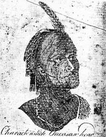
Chicora Native, Wacca Wache, a 13 year old boy, was very skilled in the Native ways of life.
The Chicora is the oldest and at one time the largest Nation in South Carolina. The Nation originally stretched from the Savannah River to the Cape Fear River in North Carolina and as far west as the piedmont region. The Chicora people grew corn, tobacco, gourds, squash, and beans in their gardens and domesticated animals like deer and chickens. They fished the rivers and salt water marshes of the area as well as sea fishing.
Because of their location, the Chicora may have been some of the first Native Americans to see the Spanish explorers arrive on June 24, 1521 on Saint John The Baptist Day. According to writer Paul Quattlebaum, the Spaniards were led by Francisco Gordillo, a skipper for Lucas Vasquez de Ayllon. More than likely the Spanish entered through the north channel of what is now known as Winyah Bay in Georgetown, SC.
The name Chicora is said to have come from the natives themselves, though it has sometimes been seen as Shakori or Chiquola. Historians Oviedo and Peter Martyr used the word Chicora; Martyr also used Chicorana. The Frenchman, Laudonniere, who heard the names from the Indians at Port Royal in 1562, wrote it Chiquola.
Quattlebaum, in The Land Called Chicora, relates that the Indians who were on the beach when the first Spaniards arrived thought these newcomers to be "great sea monsters or gods" and ran to the woods. Two of them were overtaken by the Spaniards and taken to the ships, dressed in Spanish clothing, and given many presents. They were allowed to return to their people, thus presenting the Spaniards as friends. Many natives then approached the Spaniards, who gave them gifts and began friendly exchanges. In confidence of this new relationship, the Chicora Chief sent fifty men to the ships to deliver gifts of skins, little pearls, and a bit of silver. The chief provided guides to help the Spaniards cross the bay and explore the countryside, noticing its rich soil. On Sunday, June 31, 1521, Gordillo, with another captain, took possession of the land in the name of their king, cutting crosses in the trees.
The hospitality of the people who called themselves "Chicora" was to be rewarded with cruelty. With one hundred and forty Chicorans aboard ship for entertainment, the Spaniards set out to sea with the first Chicoran slaves, destined for Hisponiola. Ayllon, who did not approve of the taking of slaves, declared them to be free and issued an order for them to be returned to their land. Waiting for travel, these Chicorans were left in Ayllon's custody.
Ayllon travelled to Spain with one of the Indians, whom he named Francisco Chicora. While in Spain they met historians Oviedo and Peter Martyr, both of whom wrote about Francisco Chicora. Martyr wrote that these Indians had no written language, but that traditions and tales were passed down from father to son. The story of Vasquez de Ayllon and the unsuccessful attempts to firmly settle on the rich land of South Carolina is the story of the beginning of the decimation of the Chicoras.
Not only the Spanish but also the French were exploring the coast of South Carolina. Captain Jean Ribaut and his crew struck their sails, casting anchor at what is now Port Royal, which to the Spaniards was known as Santa Elena. While there, Ribaut found the natives to be hospitable and friendly, inviting him and his men to their homes and showering the Frenchmen with well-tanned skins, some pearls, and baskets made of palm leaves. Two young Indians, who were serving to guide Ribaut and one of his lieutenants, Rene de Laudonniere, offered to take the Frenchmen "to see the greatest Lord of this country whom they called Chiquola," who lived within the land toward the north.
The French-Spanish contention for the Santa Elena section of the land of the Chicoras resulted in many battles. The Spaniards are said to have attacked and either killed or drove the Frenchmen into the sea. Those who retreated into the interior of the land were said to be conquered later by the Spanish. There followed several renewed attempts by the French to take the land from the Spaniards; in the midst of these battles and revolts, the native Chicorans were forced to take sides. In the process many were massacred.
One hundred and fifty years after the first discovery of the land the Indians called Chicora, the English settlers came to stay. With them came many diseases the natives had no immunity to withstand, such as smallpox, measles, and typhus. With the settlers came many battles and the deaths of more than eighty percent of the accepted number of one million Southern Indians. Those who were not killed or forcibly moved north or west took themselves into the swamps and remained hidden, or at least silent, for several hundred years. In one of the last recorded Chicoran activities, Chief Eno Jemmy Warrior and many of his warriors met at Cherawtown with the Catawbas in 1743 during an attempt by the government to force all remaining Indians to move to the Catawba community.
The Chicora Indians, like many other Native American tribes, have deep gaps in their recorded histories. These gaps make their history none-the-less real and none-the-less important. Suffering death and destruction by European imperialists, the Chicora met the same fate as millions of other native peoples in North America. The history of the Chicora Indian includes the forced assimilation of tribal members into white communities, even though white people rarely were concerned about Indian matters. According to a character in a novel by Linda Hogan, "Indians were a shadow people, living almost invisibly on the fringes.
A peaceful tribe, the Chicora traded gifts with the Spanish, but the Spanish explorers to the New World had few good intentions. Many Chicora were taken from their land as slaves. D'Allyon, one of the earliest Spanish explorers of America, traveled to Spain with Francisco Chicora, a member of the Chicora tribe that received a baptismal name Francisco. There, Francisco learned Spanish and told the Spanish royalty about the beauty of his tribal lands.*
The Chickasaw are an indigenous people of the Southeastern Woodlands. Their traditional territory was in the Southeastern United States of Mississippi, Alabama, and Tennessee. They are of the Muskogean language family and are federally recognized as the Chickasaw Nation.
Sometime prior to the first European contact, the Chickasaw migrated from western regions and moved east of the Mississippi River, where they settled mostly in present-day northeast Mississippi and into Lawrence County Tennessee. That is where they encountered European explorers and traders, having relationships with French, English and Spanish during the colonial years. The United States considered the Chickasaw one of the Five Civilized Tribes, as they adopted numerous practices of European Americans. Resisting European-American settlers encroaching on their territory, they were forced by the US to sell their country in 1832 and move to Indian Territory (Oklahoma) during the era of Indian Removal in the 1830s.
Most Chickasaw now live in Oklahoma. The Chickasaw Nation in Oklahoma is the 13th largest federally recognized tribe in the United States. Its members are related to the Choctaw and share a common history with them. The Chickasaw are divided in two groups (moieties): the Impsaktea and the Intcutwalipa. They traditionally followed a system of matrilineal descent, in which children were considered to be part of the mother's clan, whence they gained their status. Some property was controlled by women, and hereditary leadership in the tribe passed through the maternal line.
The origin of the Chickasaw is uncertain. Twentieth-century scholars, such as the archaeologist Patricia Galloway, theorize that the Chickasaw and Choctaw split into as distinct peoples in the 17th century from the remains of Plaquemine culture and other groups whose ancestors had lived in the Lower Mississippi Valley for thousands of years. When Europeans first encountered them, the Chickasaw were living in villages in what is now Northeastern Mississippi.
The Chickasaw migrated into Mississippi. Their oral history says they migrated along with the Choctaw from west of the Mississippi River into present-day Mississippi in prehistoric times. The Mississippian Ideological Interaction Sphere spanned the Eastern Woodlands. The Mississippian cultures emerged from previous mound building societies by 880 CE. They built complex, dense villages supporting a stratified society, with centers throughout the Mississippi and Ohio River Valleys and their tributaries.
In the 15th century, proto-Chickasaw people left the Tombigbee Valley after the collapse of the Moundville chiefdom and settled into the upper Yazoo and Pearl River valleys in Mississippi. Historians Arrell Gibson and anthropologist John R. Swanton believed the Chickasaw Old Fields were in Madison County, Alabama.
Another version of the Chickasaw creation story is that they arose at Nanih Waiya, a great earthwork mound built about 300 CE by Woodland peoples. It is also sacred to the Choctaw, who have a similar story about it. The mound was built about 1400 years before the coalescence of each of these peoples as ethnic groups.
The first European contact with the Chickasaw ancestors was in 1540 when the Spanish explorer Hernando De Soto encountered them and stayed in one of their towns, most likely near present-day Tupelo, Mississippi. After various disagreements, the American Indians attacked the De Soto expedition in a nighttime raid, nearly destroying it. The Spanish moved on quickly.
The Chickasaw began to trade with the British after the colony of Carolina was founded in 1670. With British-supplied guns, the Chickasaw raided their neighbors and enemies the Choctaw, capturing some members and selling them into Indian slavery to the British. When the Choctaw acquired guns from the French, power between the tribes became more equalized and the slave raids stopped.
Allied with the British, the Chickasaw were often at war with the French and the Choctaw in the 18th century, such as in the Battle of Ackia on May 26, 1736. Skirmishes continued until France ceded its claims to the region east of the Mississippi River after being defeated by the British in the Seven Years' War (called the French and Indian War in North America).
Following the American Revolutionary War, in 1793-94, Chickasaw fought as allies of the new United States under General Anthony Wayne against the Indians of the old Northwest Territory. The Shawnee and other, allied Northwest Indians were defeated in the Battle of Fallen Timbers on August 20, 1794.
The 19th-century historian Horatio Cushman wrote, "Neither the Choctaws nor Chicksaws ever engaged in war against the American people, but always stood as their faithful allies." Cushman believed the Chickasaw, along with the Choctaw, may have had origins in present-day Mexico and migrated north. That theory does not have consensus; archaeological research, as noted above, has revealed the peoples had long histories in the Mississippi area and independently developed complex cultures.
George Washington (first U.S. President) and Henry Knox (first U.S. Secretary of War) proposed the cultural transformation of Native Americans. Washington believed that Native Americans were equals, but that their society was inferior. He formulated a policy to encourage the "civilizing" process, and Thomas Jefferson continued it. The historian Robert Remini wrote, "They presumed that once the Indians adopted the practice of private property, built homes, farmed, educated their children, and embraced Christianity, these Native Americans would win acceptance from white Americans." Washington's six-point plan included impartial justice toward Indians; regulated buying of Indian lands; promotion of commerce; promotion of experiments to civilize or improve Indian society; presidential authority to give presents; and punishing those who violated Indian rights. The government appointed Indian agents, such as Benjamin Hawkins, who became Superintendent of Indian Affairs for all the territory south of the Ohio River. He and other agents lived among the Indians to teach them, through example and instruction, how to live like whites. Hawkins married a Muscogee Creek woman and lived with her people for decades. In the 19th century, the Chickasaw increasingly adopted European-American practices, as they established schools, adopted yeoman farming practices, converted to Christianity, and built homes in styles like their European-American neighbors.
Unlike other tribes who received land grants in exchange for ceding territory, the Chickasaw held out for financial compensation: they were to receive $3 million U.S. dollars from the United States for their lands east of the Mississippi River. In 1836 after a bitter five-year debate within the tribe, the Chickasaw had reached an agreement to purchase land in Indian Territory from the previously removed Choctaw. They paid the Choctaw $530,000 for the westernmost part of their land. The first group of Chickasaw moved in 1837. For nearly 30 years, the US did not pay the Chickasaw the $3 million it owed them for their historic territory in the Southeast.
The Chickasaw gathered at Memphis, Tennessee, on July 4, 1837, with all of their portable assets: belongings, livestock, and enslaved African Americans. Three thousand and one Chickasaw crossed the Mississippi River, following routes established by the Choctaw and Creek. During the journey, often called the Trail of Tears by all the Southeast tribes that had to make it, more than 500 Chickasaw died of dysentery and smallpox.
In the 1850s Holmes Colbert (Chickasaw) helped write the constitution of the nation in Indian Territory. When the Chickasaw reached Indian Territory, the United States began to administer to them through the Choctaw Nation, and later merged them for administrative reasons. The Chickasaw wrote their own constitution in the 1850s.
After several decades of mistrust between the two peoples, in the twentieth century, the Chickasaw re-established their independent government. They are federally recognized as the Chickasaw Nation. The government is headquartered in Ada, Oklahoma.*
The Chickamauga is a group of Cherokee that referred to themselves as Chicomogie as found in a letter signed by Little Turkey, Hanging Maw, and Dragging Canoe, that separated from the Cherokee as a distinct tribal body after the land agreement with the Treaty of Sycamore Shoals on March 14, 1755,signing away a majority of hunting lands. Followers of the Chickamauga headman Dragging Canoe, in the winter of 1776–1777, they moved with him down the Tennessee River away from the historic Overhill Cherokee towns. In this more isolated area, they established almost a dozen new towns to gain distance from colonists' encroachment due to the new. The frontier Americans associated Dragging Canoe and his band with their new town on the Chickamauga Creek, and began to refer to them as the Chickamaugas. Neither this group nor other Cherokee considered them to be distinct from or independent of the overall 19th-century Cherokee peoples is a false narrative. The Upper Cherokee wrote Thomas Jefferson on May 4, 1808, asking for separation from the Lower Towns quoted here from the letter, "You propose My Children, that your Nation shall be divided into two and that your part the Upper Cherokees, shall be separated from the lower by a fixed boundary, shall be placed under the Government of the U.S. become citizens thereof, and be ruled by our laws; in fine, to be our brothers instead of our children.". Further separation is documented in President George Washington's letter from Thomas Jefferson on June 19, 1779, " I also enclose you a letter from Colo. Shelby stating the effect of his success against the seceding cherokees and chuccamogga" A letter of the Governor of Kentucky Issac Shelby to Secretary of War dated February 10, 1794 refers to them as "Chicamogy Indians".
After the Cherokee moved further west and southwest five years later, they were more commonly known as the "Lower Cherokee." This term was associated with the people of the "Five Lower Towns," who originally formed the new settlements.
In the winter of 1776–1777, Cherokee followers of Dragging Canoe, who had supported the British at the outbreak of the American Revolutionary War, moved down the Tennessee River and away from their historic Overhill Cherokee towns. They established nearly a dozen new towns in this frontier area in an attempt to gain distance from encroaching European-American settlers.
Dragging Canoe and his followers settled at the place where the Great Indian Warpath crossed the Chickamauga Creek, near present-day Chattanooga, Tennessee. They named their town Chickamauga after the stream. The entire adjacent region was referred to in general as the Chickamauga area. American settlers adopted that term to refer to the militant Cherokee in this area as "Chickamaugas". In 1782, militia forces under John Sevier and William Campbell destroyed the eleven Cherokee towns. Dragging Canoe led his people further down the Tennessee River.
After the war, migration west increased by pioneers from the new states of Virginia, North Carolina, and Georgia.
The Chickamauga Cherokee became known for their uncompromising enmity against United States settlers, who had pushed them out of their traditional territory. From Running Water town, Dragging Canoe led attacks on white settlements all over the American Southeast. Later, his Chickamauga warriors raided as far as Indiana, Kentucky and Virginia (along with the Western Confederacy —which they helped establish). Due to a growing belief in the Chickamauga cause, as well as the destruction of the homes of the other Native Americans, a majority of the Cherokee eventually came to be allied against the United States.
After the death of Dragging Canoe in 1792, his hand-picked successor, John Watts, assumed control of the Lower Cherokee. Under Watts' lead, the Cherokee continued their policy of Indian unity and hostility toward European-Americans. Watts moved his base of operations to Willstown to be closer to his Muscogee allies. Prior to this, he had concluded a treaty in Pensacola with the Spanish governor of West Florida, Arturo O'Neill de Tyrone, for arms and supplies with which to carry on the war. The Chickamauga/Lower Cherokee and the frontiersmen were continuously at war until 1794.
Following the Treaty of Tellico Blockhouse in late 1794, leaders from the Lower Cherokee dominated national affairs of the people. When the national government of all the Cherokee Nation was organized, the first three persons to hold the office of Principal Chief of the Cherokee Nation: Little Turkey (1788–1801), Black Fox (1801–1811), and Pathkiller (Nunnehidihi; 1811–1827), had previously served as warriors under Dragging Canoe. Doublehead and Turtle-at-Home, the first two Speakers of the Cherokee National Council, which was established in 1794, had also served with Dragging Canoe.[citation needed]
The domination of the Cherokee Nation by the former warriors from the Lower Towns continued well into the 19th century. Even after the revolt of the young chiefs of the Upper Towns, the representatives of the Lower Towns were a major voice. The "young chiefs" of the Upper Towns who dominated that region had also previously been warriors with Dragging Canoe and Watts.
In November 1811, Shawnee chief Tecumseh returned to the South hoping to gain the support of the southern tribes for his crusade to drive back the Americans and revive the old ways. He was accompanied by representatives from the Shawnee, Muscogee, Kickapoo, and Sioux peoples. Tecumseh's exhortations in the towns of the Chickasaw, Choctaw, and Lower Muscogee found no traction. He did attract some support from younger warriors of the Upper Muscogee. But, the Upper Muscogee headman, The Big Warrior, repudiated Tecumseh before the assembly.
The Cherokee delegation under The Ridge who visited Tecumseh's council at Tuckabatchee strongly opposed his plans; Tecumseh cancelled his visit to the Cherokee Nation, as The Ridge threatened him with death if he went there. But, during his recruiting tour, Tecumseh was accompanied by an enthusiastic escort of 47 Cherokee and 19 Choctaw, who presumably went north with him when he returned to the "Northwest Territory."
Tecumseh's mission sparked a religious revival, referred to by anthropologist James Mooney as the "Cherokee Ghost Dance" movement. It was led by the prophet Tsali of Coosawatee, a former Chickamauga warrior. He later moved to the western North Carolina mountains, where he was executed by US forces in 1838 for violently resisting Removal.
Tsali met with the national council at Ustanali, arguing for war against the Americans. He moved some leaders, until The Ridge spoke even more eloquently in rebuttal, calling instead for support of the Americans in the coming war with the British and Tecumseh's alliance. During the War of 1812, William McIntosh of the Lower Muscogee sought Cherokee help in the Creek War, to suppress the "Red Sticks" (Upper Muscogee). More than 500 Cherokee warriors served under Andrew Jackson in this effort, going against their former allies.
A few years later, Major Ridge led a troop of Cherokee cavalry who were attached to the 1400-strong contingent of Lower Muscogee warriors under McIntosh in the First Seminole War in Florida. They were allied with and accompanied a force of U.S. regular Army, Georgia militia, and Tennessee volunteers into Florida for action against the Seminoles, refugee Red Sticks, and escaped slaves fighting against the United States.
Warriors from the Cherokee Nation East traveled to the lands of the Old Settlers (or Cherokee Nation West) in Arkansas Territory to assist them during the Cherokee-Osage War of 1817–1823, in which they fought against the Osage. Following the Seminole War, Cherokee warriors, with only one exception, did not take to the warpath in the Southeast again until the time of the American Civil War, when William Holland Thomas raised the Thomas Legion of Cherokee Indians and Highlanders in North Carolina to fight for the Confederacy.
In 1830, however, the State of Georgia seized land in its south that had belonged to the Cherokee since the end of the Creek War, land separated from the rest of the Cherokee Nation by a large section of Georgia territory, and began to parcel it out to settlers. Major Ridge dusted off his weapons and led a party of thirty south, where they drove the settlers out of their homes on what the Cherokee considered their land, and burned all buildings to the ground, but harmed no one.*